4,725 Miles: Chile, Part IV (Into the Andes!)

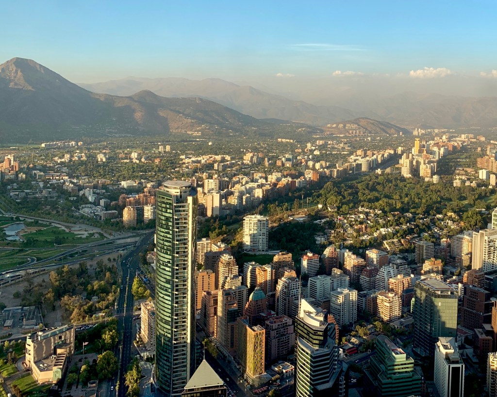
Tuesday arrived and so did–thankfully–our last day with the car. Not only was Russ growing weary of being our chauffeur, the boys were also growing weary of sitting three across in the backseat.

Our last day trip out of Santiago was a short one, distance wise–only 102 miles or so–but we were going to another once-in-a-lifetime place and on a once-in-a-lifetime road, so I was quite excited.

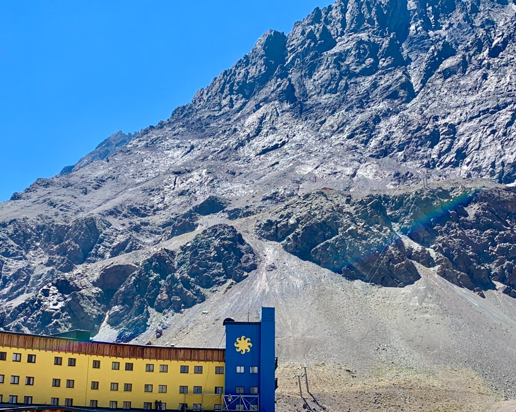
Located at 9,450 feet above sea level, Portillo is one of the go-to destinations for snow skiing during the North American summer, especially for Olympic-caliber skiers. As we were there near the end of the South American summer (and, um, are not Olympic-caliber skiers), we weren’t able to ski, but that didn’t stop me from really wanting to see this place.


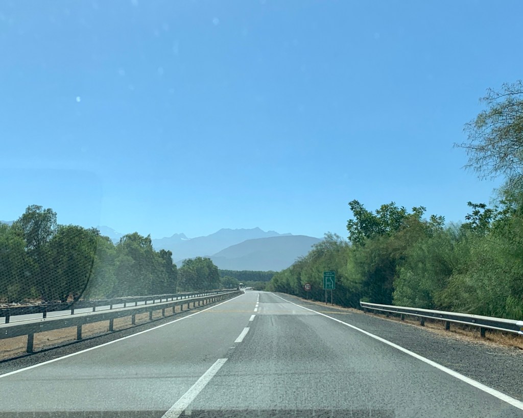
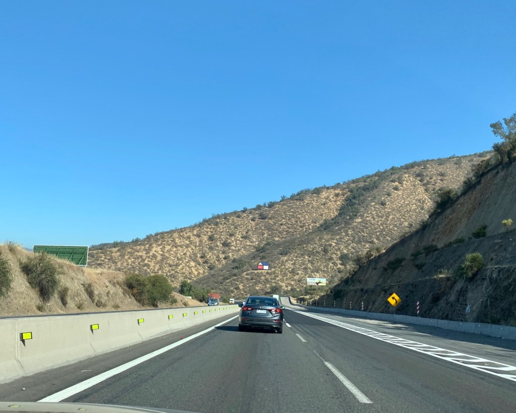
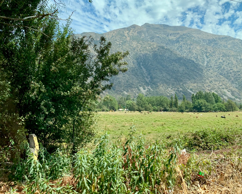
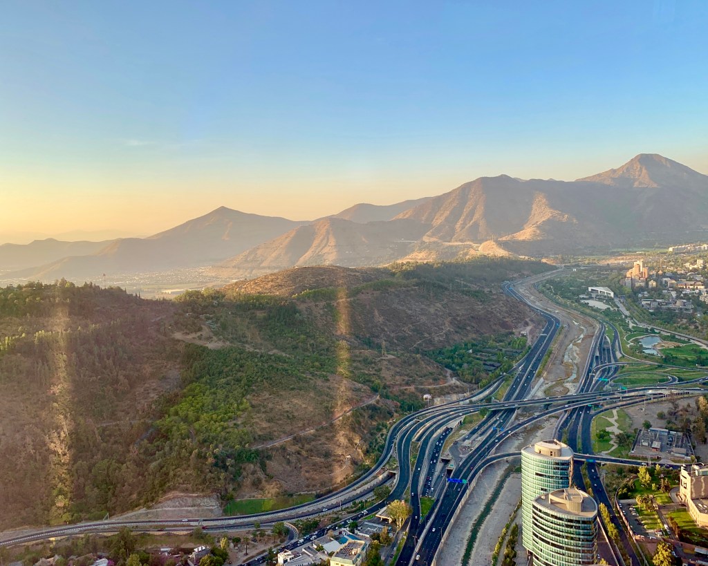
The first hour or so of the drive is a piece of cake. We barreled down the highway out of Santiago and parallel to the Andes mountains.

Every once in awhile, we’d come upon areas that were bright green and lush–a huge change from the rest of the scenery. On the other side of the highway from this green area (above) were the most pitiful looking brown squatty bushes somehow growing on brown dusty land.

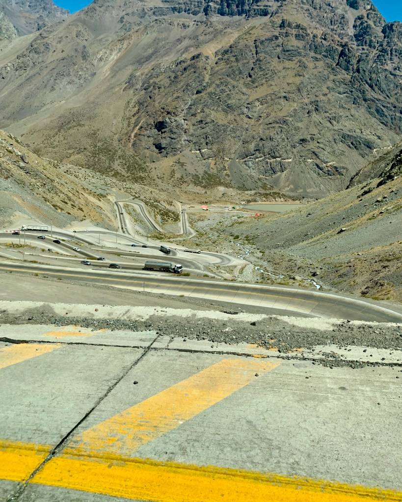
Once through the bizarre truck-stop of a town called San Miguel, you’ll hang what feels like a complete U-turn onto the infamous Chilean Ruta 60 and begin the journey up the mountain.

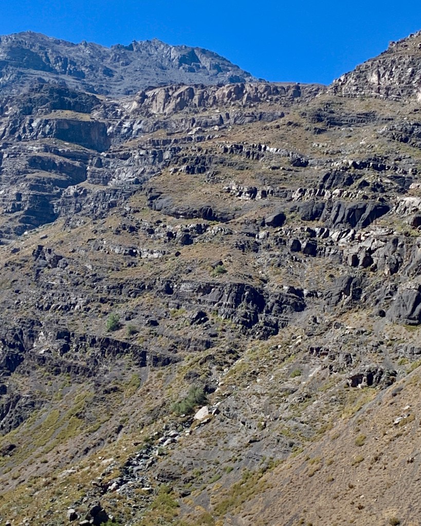
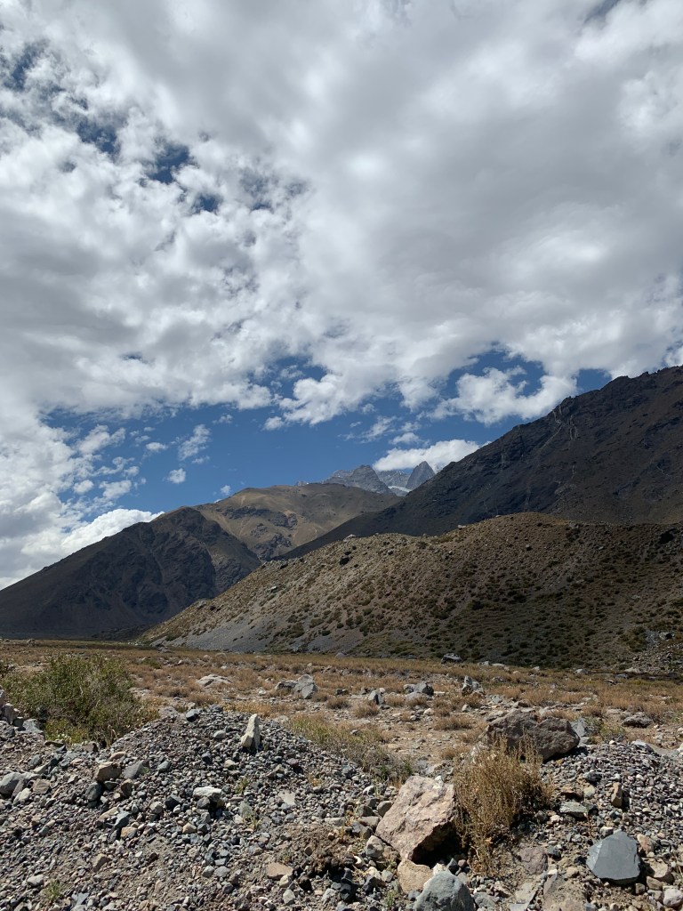
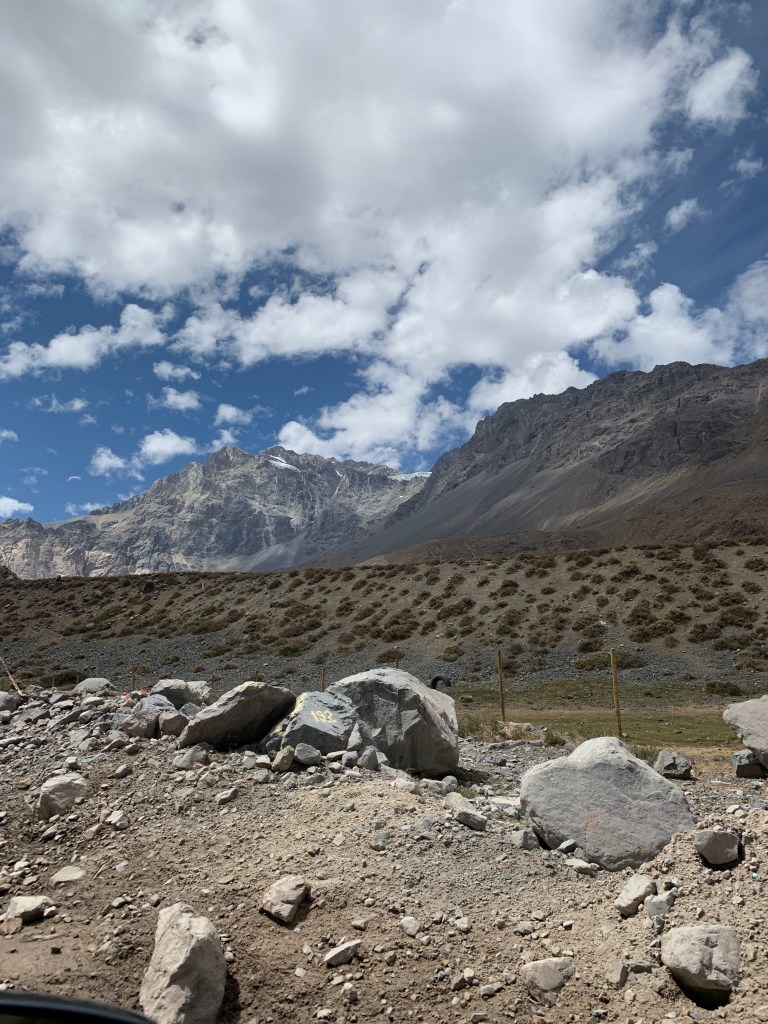
The landscape began to change dramatically.

The road signs began to change dramatically, too. For the record, Chile doesn’t play around with their road signs. We saw Volcano Evacuation Routes, Earthquake Evacuation Routes, Horse-and-Buggy Crossing signs, and this gem…

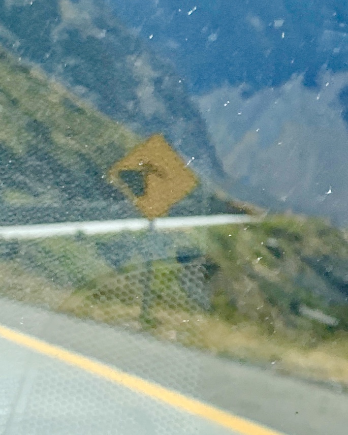
…the old Watch Out or Your Car is Going to Go Careening Over the Edge of the Mountainside sign. (I just wish I’d gotten a better shot of it…)

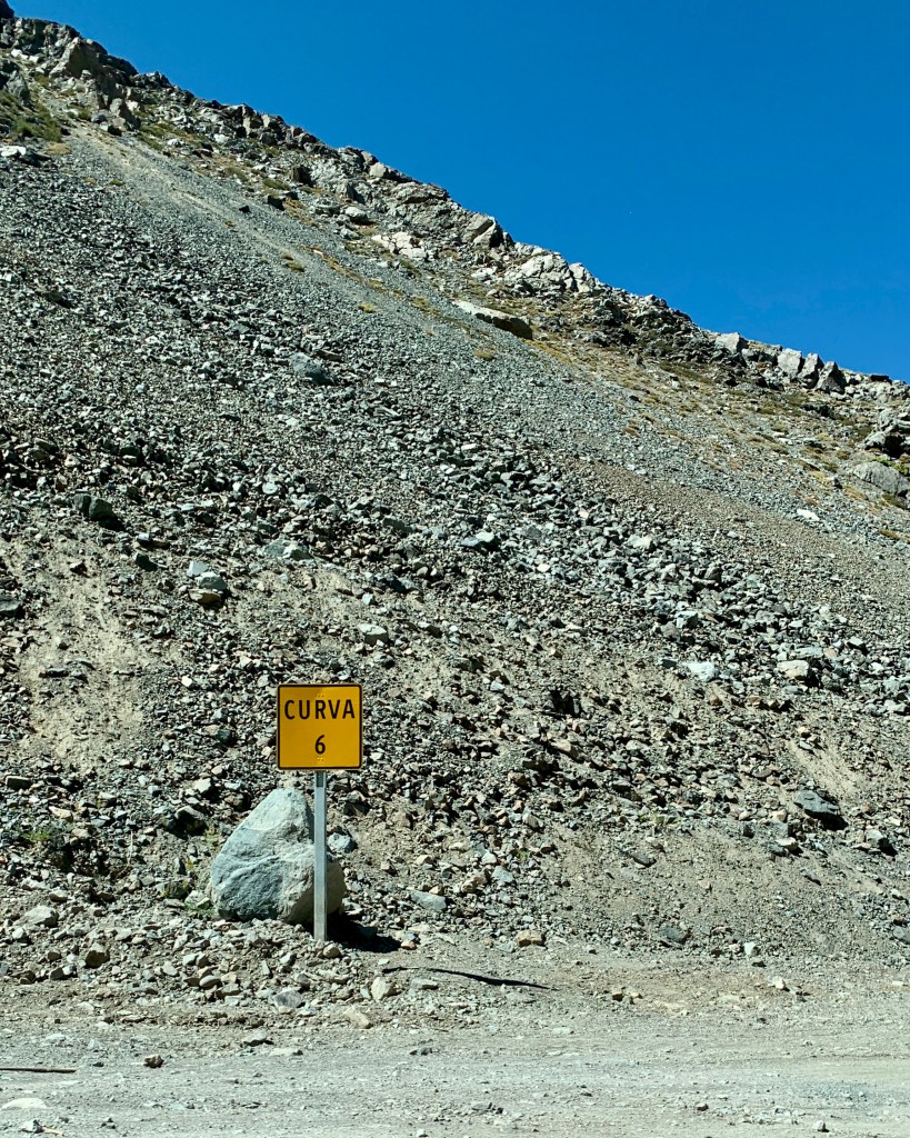
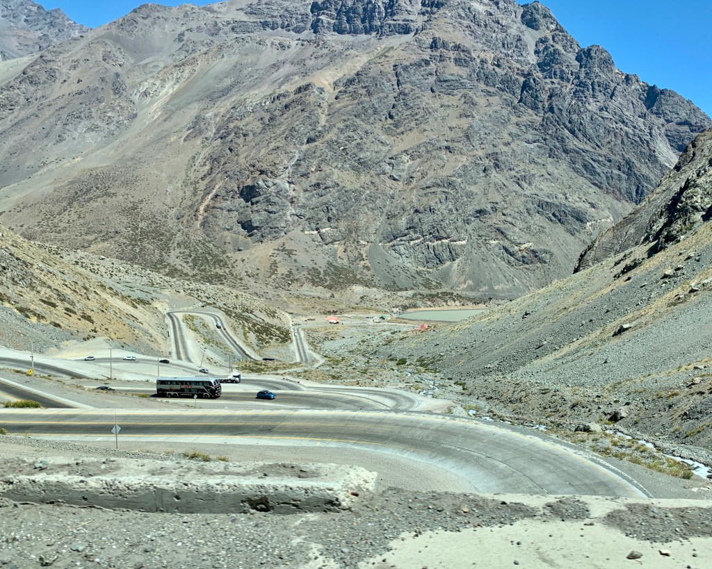
The most famous part of Ruta 60 is the 29-curve switchback that leads the final few miles up to Portillo. Our good friends over at the Dangerous Roads blog (mentioned a few posts ago) have also listed this highway on their collection of potentially disastrous roads for you to even consider visiting, and even said this portion of the trip “demands 100% concentration.” Love the doom-and-gloom, btw. The authors of that blog must be a real joy to hang out with.

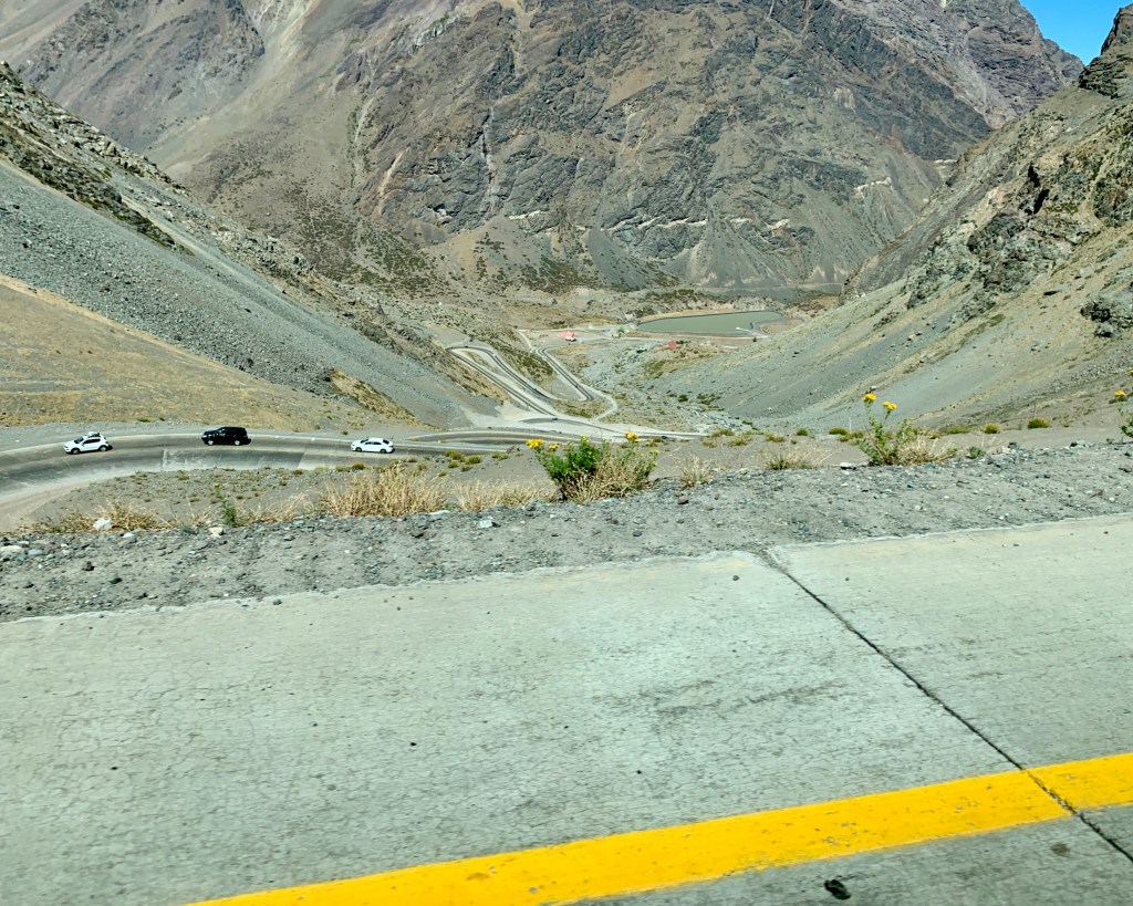
Russ did use 100% concentration, and we all found this part of our journey absolutely fascinating. The photos we took do not do it justice…

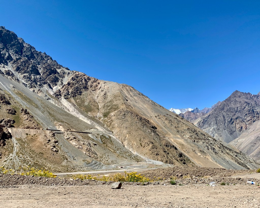
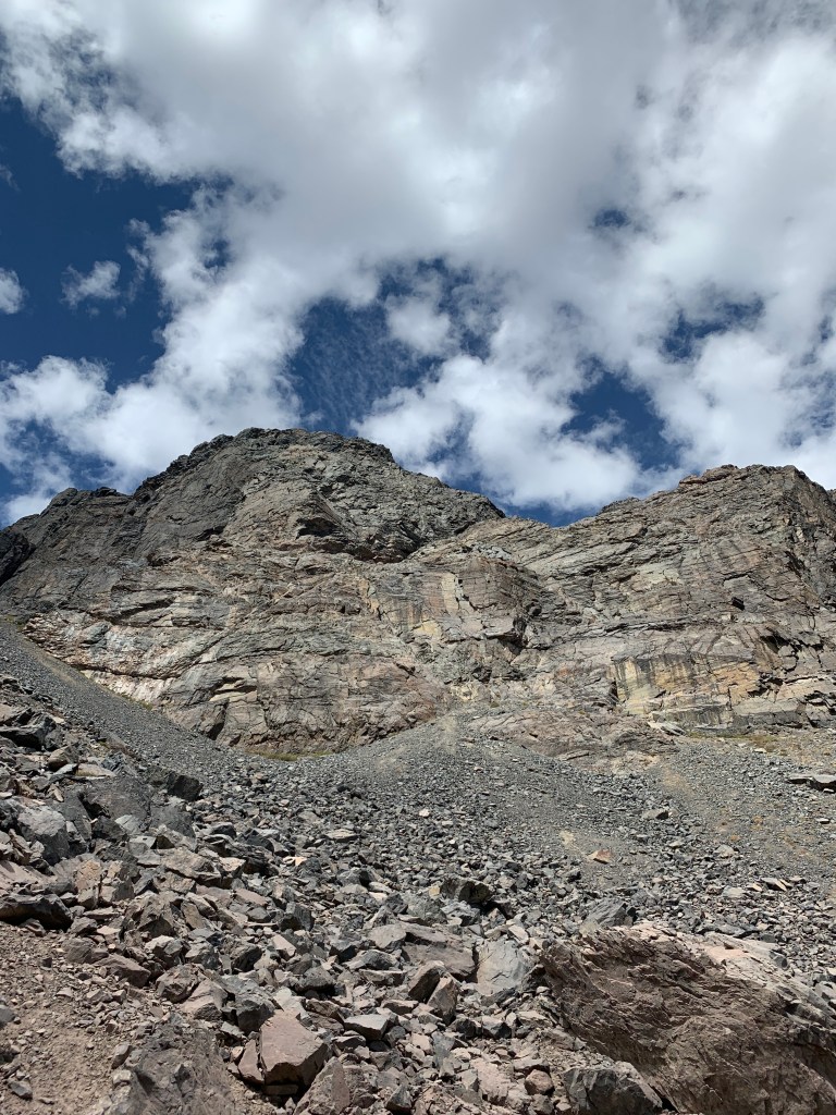
…nor do my photos do the Andes Mountains justice. The scale of these guys is ineffable.

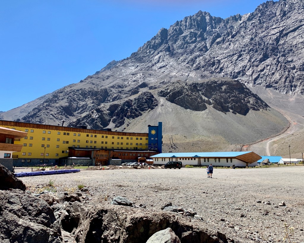
We pulled up to the resort, and the Vacation and The Shining jokes began.

“Sorry, folks; park’s closed. Moose out front shoulda told ya.”

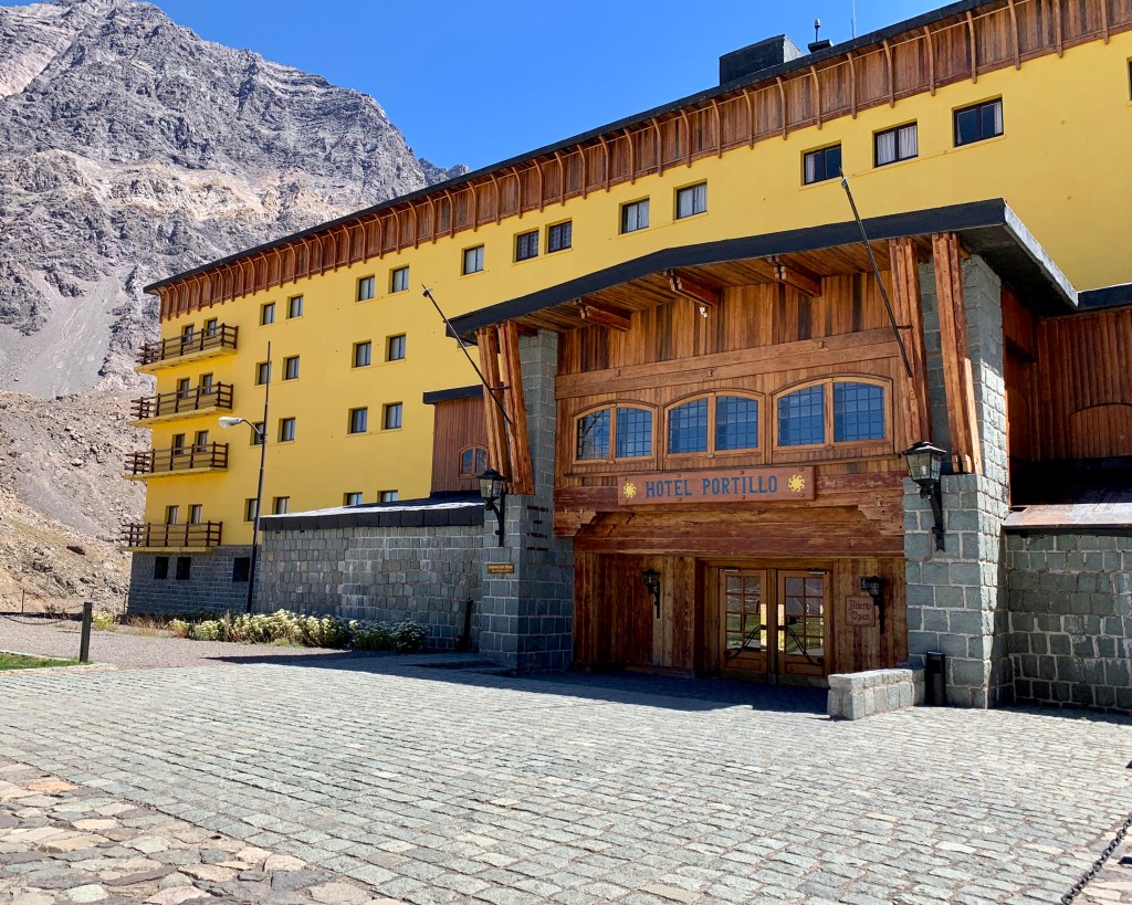
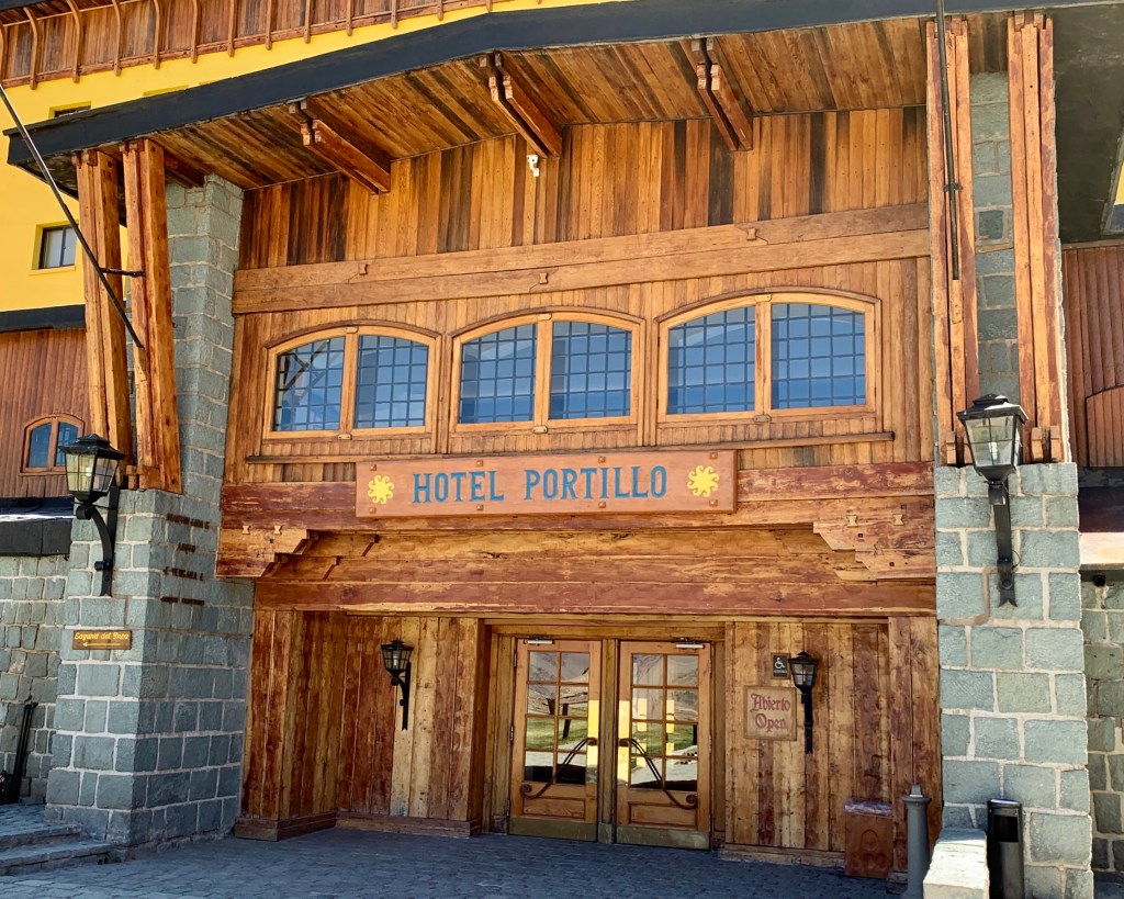
The resort wasn’t closed (thank goodness; I would have endured family mutiny if that had been the case), but it wasn’t exactly hopping, either.

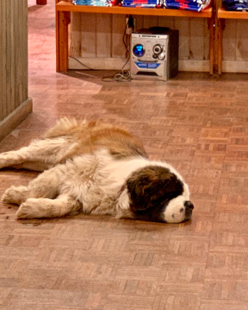
Petra the St. Bernard is the official greeter at Portillo, but she was taking it easy today.

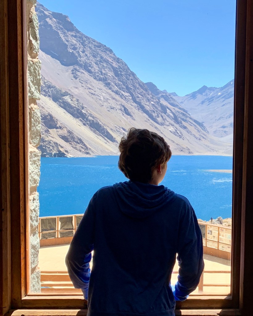
We moseyed into the dining room–which was completely empty–and sauntered over to the windows to take a peek.

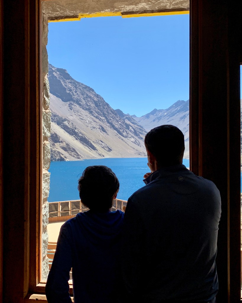
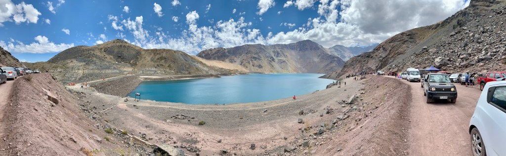
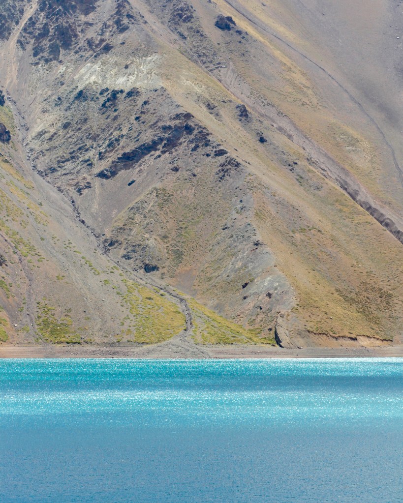
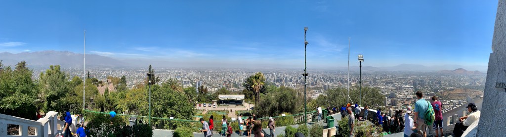
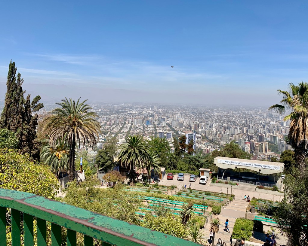
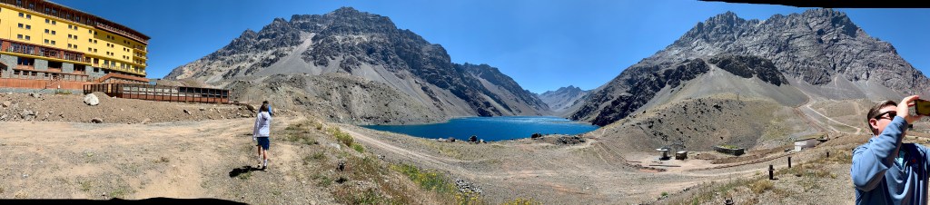
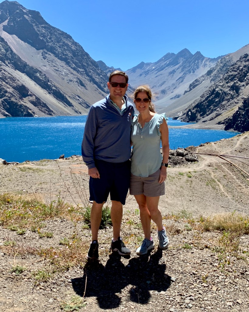
The view was spectacular.

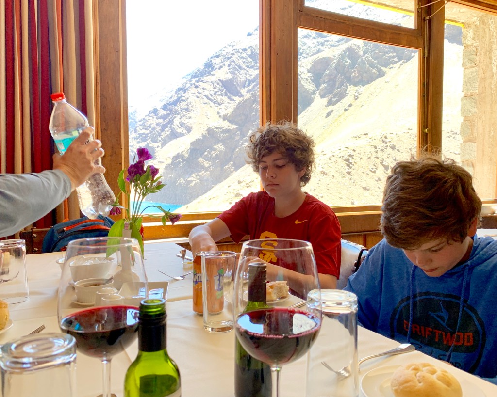
We turned around and were spooked greeted by a waiter who’d snuck up on us like a Prius. He ushered us over to a table, and we sat down for lunch.


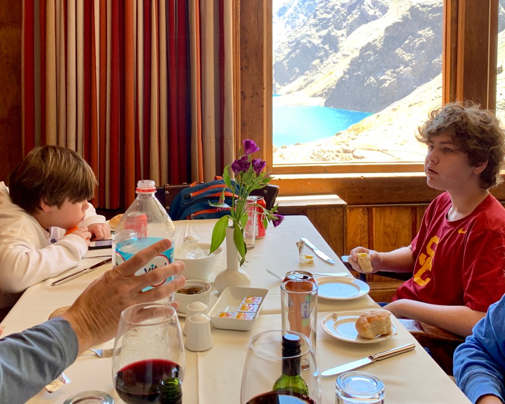
It’s hard to see, but if you look through the wine glass on the left, you’ll see a small white ramekin with a tiny spoon. Inside that was some of the most delicious deliciousness I’ve ever had (my mouth is watering just thinking about it): a garlic-tomato-olive-oil mixture that I would have bought gallon jugs of if they’d only sold it.

Bonus: no vampires (or family members) messed with me for days afterwards.

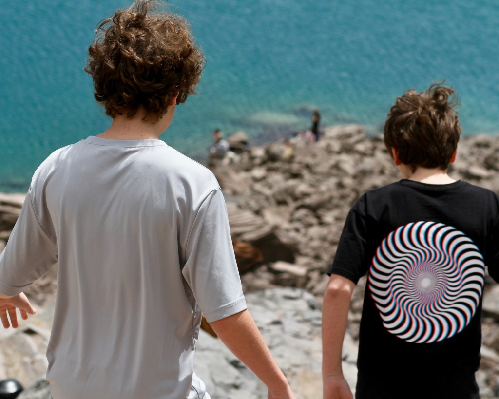
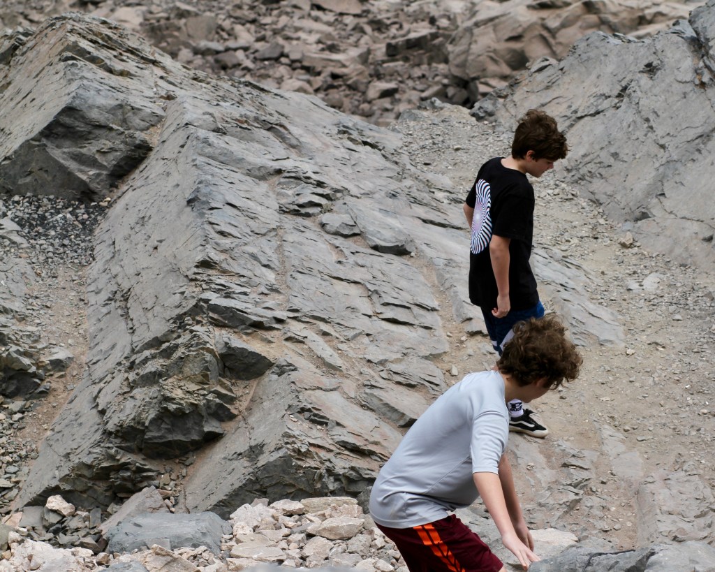
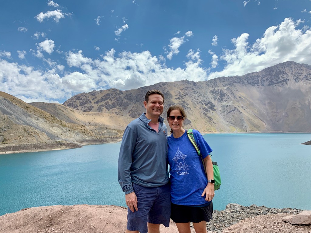
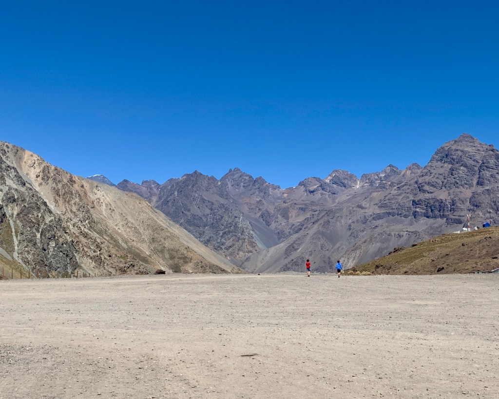
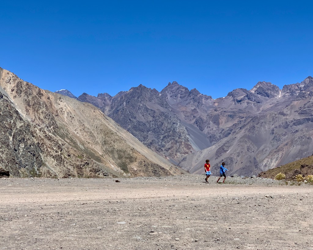
After lunch, we walked around the resort a bit. It was crisp, clear, windy, and amazing. And, again, these photos don’t do the scale of the mountains justice at all…

straight down the mountain, folks
seeing it without snow is sort of like seeing how the sausage is made…
in front of Laguna del Inca–which is supposedly haunted

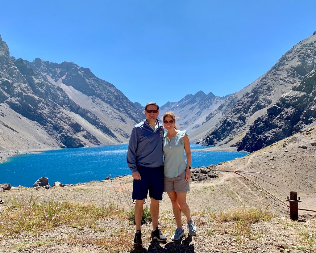
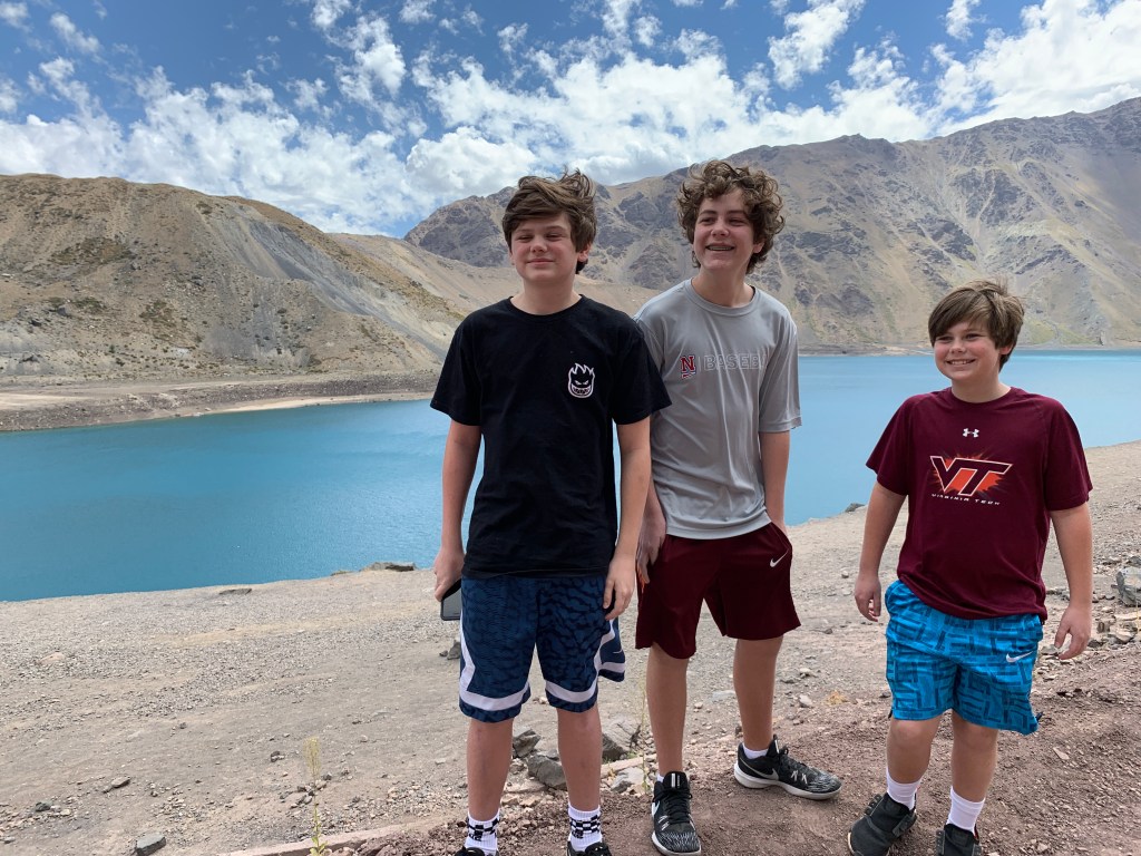
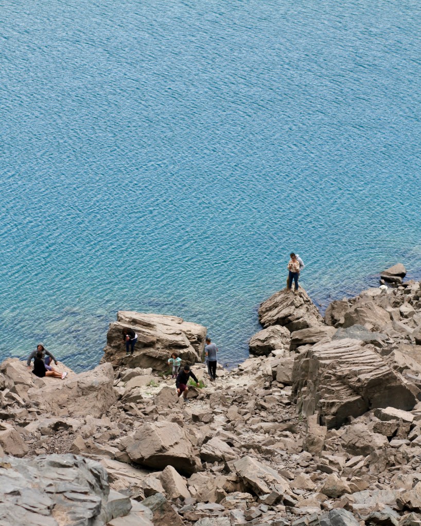
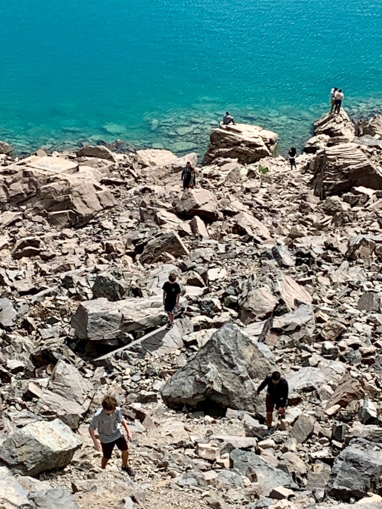
Looking around at all the incredibly steep slopes–that lead straight to that lake–we really couldn’t imagine skiing here.

Interesting tidbit: we were just 3 miles from the Argentinian border. Crossing the border is apparently a mega-hassle, so I reluctantly cast this pipe dream to the side when planning our trip. At one point, I’m certain I mentioned this to Russ and the boys, and they agreed that it was a little crazy to possibly endure mayhem just to say we’d been to Argentina.

Apparently, the family forgot that I told them it could take hours to get through Argentinian customs only for us to get a passport stamp and turn right back around. Before we turned out of Portillo, there was a whole lot of chatter about just going for it and making a run for the border. As we had not gotten a permit to cross the border from the rental car office (and as an Argentinian gulag wasn’t on our vacation destinations), any further discussion of such an attempt was a moot point. Then we watched an 18-wheeler pick up two backpackers and continue its slow journey towards the Tunel Cristo Redentor , and our talk shifted from how bad a life choice it is to make a sketchy border crossing to how bad a life choice it is period to hitch-hike, much less to hitch-hike on an 18-wheeler across a border. Egads.

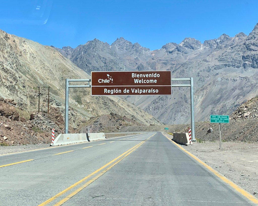
So when we passed the Welcome to Chile sign, we did a little happy dance even though we’d actually not left the country.

The drive back down Ruta 60’s 29 curves was just as thrilling as the drive up.

good gracious, you all are so thankful you’re not on that bus!

Once back through San Miguel, the rest of the drive back to Santiago was perfectly uneventful. Russ dropped us off at the apartment and braved rush hour traffic to return the car (not sure anyone has ever been happier to ditch a vehicle than he was) while we showered and caught up on our screen time.

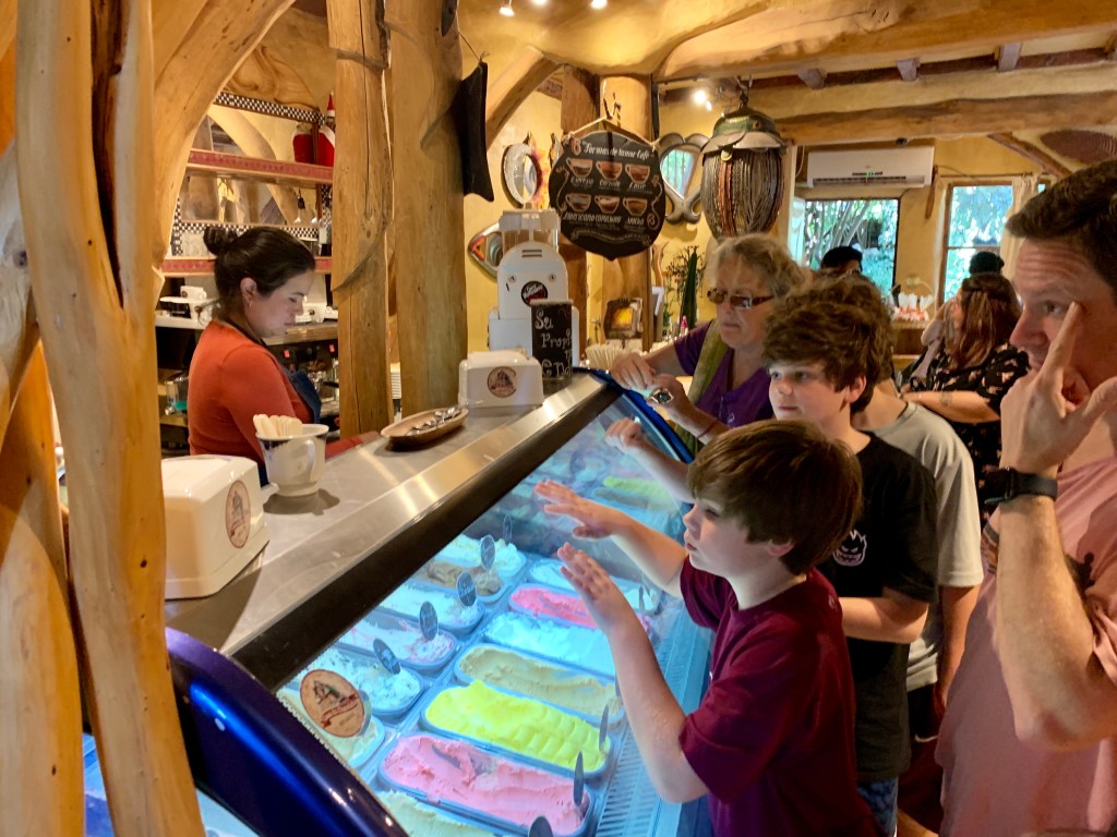
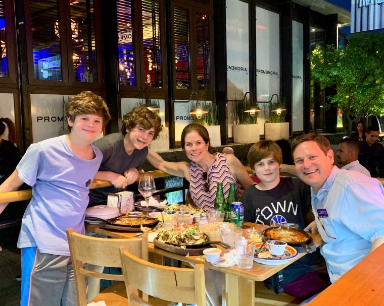
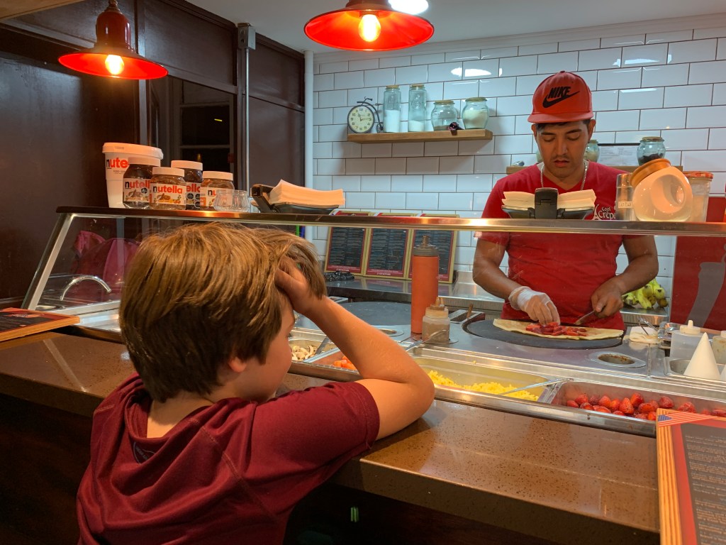
Dinner that night was back at Patio Bellavista; Theo finished up with a dessert crepe while the rest of us did some souvenir shopping.

Road tripping in Chile was tiring, to say the least, but we’re glad we did it (at least some of us are…our driver might dissent). Our trip up to the Andes was refreshing and unique and surprisingly non-motion-sickness inducing. I’m going to branch out and say driving around (and navigating) the outskirts of Santiago was manageable as long as there were actual roads (looking at you, Embalse del Yeso). That doesn’t mean we weren’t ready to be done with the responsibility of wheels, though.

We had just one full day left in Santiago…


4,725 Miles: Chile, Part III (The Most Colorful Place in the Country!)

We were up and at ’em rather early on Monday; road trip #2 had us headed westwards towards the ocean. Everyone was rested and excited to go to a beach, though please let the record state that I’d provided ample forewarning that the beaches at Valparaiso and Vina del Mar were not going to be like the beaches our little people absolutely adore.

The Chileans–being exceptional miners and all–wholeheartedly believe going through a mountain is easier than going around it (or over it). The drive to Valparaiso is a short, pretty one that ambles across the Casablanca wine country (which we sadly saw only from the highway) and through several, lengthy mountain tunnels. Roughly 90 minutes after we left our apartment, we pulled into the parking garage where we were to meet our tour guide, Michael the German Pirate.

(Thank goodness Russ insisted on a tour guide; we’d have never, ever figured out Valpo otherwise.)

Before I go any further, I want to shout from the rooftops that Michael was an excellent choice for a guide. He replied to my initial email in a matter of minutes, spoke fluent English, and was more than happy to accommodate some surly teenagers.

Valparaiso was once a very weathy shipping town and layover point for folks making the insanely long and hard journey from Europe around Cape Horn. Then a little thing came along called an earthquake (in 1906) and another little thing came along called the Panama Canal (in 1914), and poor Valpo lost its footing as a South American metropolis.

In keeping with Chilean geography in general, Valparaiso is incredibly unique. Tall, tall cliffs drop straight down to the sea. To help with getting up and down these gigantic hills, the city built a system of funiculars–many of which are still in use 100 years later. Its buildings and alleyways are covered with murals painted by some pretty talented folks. All of these factors have helped Valparaiso be declared a UNESCO World Heritage Site, something the city takes very seriously; roughly only 1,000 sites on the entire planet have earned UNESCO World Heritage status.

but before we got to the heart of our tour, we encountered this cat…
he’s the live mascot (Dr. Simi) of a main chain of pharmacies, and he was awesome
(though I doubt he’s UNESCO approved…)

After giving us a quick peek of the city from the top of the parking garage, Michael then took us across town on the antiquated trolleybus–actually a Chilean national monument–where we got our first taste of Valpo’s infamous street art.

The work above, Solsticio de Invierno, was created by UnKolorDistinto, a couple who is regularly commissioned to design and paint various public art murals.

Street art is the name of the game in Valparaiso, and almost all of it is pretty spectacular, particularly when given the grand scale of it.

yes, one of Dr. Simi’s balloons is still lingering with us…

Michael took us by one of Valpo’s most popular places for chorrillana (Casino Social J. Cruz –one of the greatest named places ever) , which is a carboholic’s dream of a dish composed of french fries covered with some type of meat, onions, cheese, and a fried egg. Michael is not a fan, and I can’t say I blame him after seeing a few plates piled sky-high go passing by. While we didn’t eat there, it was still a great stop on the tour because the place doubles as a knick-knack hoarder’s wildest dream. (Side note: J. Cruz completely reminded Russ and me of another bizarre place: Takatakata–hands down, the dive-iest dive bar on the planet–which we managed to visit and live to tell about. It’s located in Buzios, Brazil. Tell Kaiser you heard about his place from me. And watch out for the machete.)

just look at all the stuff…photos, trinkets, live animals (there was a cat slinking around on that shelf
behind Michael on the turquoise wall)

Time for a funicular. We rode the Reina Victoria up to the top of Cerro Concepcion and started our search for a lunch place without felines prowling around inside of it.

our first (and only–not a fan of egg whites) Pisco Sour

On the way to lunch, Michael told us about an unbelievable mountain bike race–the Cerro Abajo–that takes place annually in Valparaiso. Racers plummet from the highest point in Valpo all the way down to the sea, lacing through narrow pathways and staircases and concluding by going through a building and jumping over an entire street. Of course the boys were immediately asking for the wi-fi password at lunch in order to track down a video of it. It’s utter insanity; consider yourselves forewarned!

After lunch, it was time for even more street art!

Finally on to Cerro Alegre! This one above, created by Art+Believe, is synonymous with Valpo; here’s a cool montage of its creation.

this shot gives you a good idea of just how steep the roads in Valpo are…

Next up, the equally as well-recognized Piano Stairs.

the Piano Stairs with uncooperative children…
Commissioning street art is big, big deal.
here the boys stand with Michael in front of The German Pirate’s mural

Sensing one of his day’s clients had likely had enough street art and was a much more business-minded individual, Michael managed to sneak us in to the Bolsa de Valores–the (sadly, now shuttered) first (and busiest) stock exchange in Latin America. The trading floor was eerie in its silence…and beautiful in its architecture.

We were all definitely hitting the wall at this point, so we asked Michael if he wouldn’t mind getting us on to the thing Tucker had been asking about since we’d gotten up that morning: the beach.

He suggested we all load up in our rental car (Russ driving, Michael in the passenger seat, and the three boys and me all crammed in the back–not the safest way to travel) and head down the road the six miles or so to Vina del Mar.


Tucker’s reaction upon FINALLY arriving at the ocean…

Of course, the ocean was freezing, but that didn’t stop Tucker from going all the way under–a decision that made for a long car ride back to Santiago for him.

We rolled back in to Santiago tired, dusty, and hungry and not willing to venture out for a proper dinner…again. After a battle royale over where to eat, we basically all pouted through the meal and then hit up the Jumbo grocery store for some provisions before heading home and to bed. We had just one last road trip ahead of us.

oh, Costanera, how convenient you were…
the aptly named Jumbo grocery–that also sold washing machines, lawn furniture, and just about anything else
you think you might possibly need…


4,725 Miles: Chile, Part II (Road Trip!)

When planning our Spring Break trip, I pummeled a sweet friend who’d actually lived in Santiago with question after question, one of which was whether or not to rent a car–specifically for a few day trips, not as our main source of transportation around the city. We felt like we were pretty savvy international drivers; we’d driven around the Arenal volcano in Costa Rica and had cruised around Normandy with zero problems.

My friend basically told us we were certifiably crazy to even consider renting a set of wheels. Lanes change direction based on the time of the day and the severity of the traffic. There are toll roads scattered all over the place, and each of them requires a different (and totally random) amount. The buses in Santiago have a mind of their own. The bicycle is the preferred mode of transit, and bikers will bob and weave their way through traffic; the last thing you want to do is hit one.

We took her kind advice, thought about it, and then threw all caution to the wind and decided to rent a car anyway.

(I did have enough common sense to plan our first day trip out of Santiago for a Sunday in hopes of avoiding the insanity of Santiago rush hour traffic and the infamous lane-direction-switching situation.)

The Embalse el Yeso was a destination that kept popping up on any search I did for day trips out of Santiago, and every suggestion to visit it also included a photo of the unbelievably clear blue water. (El Yeso is actually a reservoir that supplies nearly all of the water for Santiago. I made the mistake of telling my sons this fact, and they all began calling it the “fake lake” as in, “why would we ever want to go to a fake lake?”)

Sunday morning arrived, and Russ set off for the Hertz rental car office while I stayed back at the apartment packing up for our adventure. He made it back in one piece about an hour later, and we loaded up and headed off.

Thank the good Lord above for GoogleMaps, international roaming on cell phones, GPS, and a semi-fluent co-pilot who also had a printed map with her.

First stop: San Jose del Maipo.

The Cajon del Maipo is a canyon in the Andes mountains a bit southeast of Santiago. San Jose is the largest town in the region. We planned on stopping here for lunch and some fresh air before tackling the crazy road leading to the embalse.

the outdoor marketplace was alive and kicking when we arrived
a possible international branch of Vidalia Pharmacy (the red, squatty building)

San Jose is a tiny place with a population of about 13,000…a solid quarter of which must be stray dogs. Seriously, there were dogs everywhere. Everywhere.

It was a dog party, a big dog party.

After scouring the village square for a decent place to eat, we settled on this place. The interior had a cute little courtyard area where we sat and also had some Billie Holiday and Louis Armstrong playing in the background, so it started out strong. Our order was lost in translation, however, which led to some creative lunching that consisted predominantly of bread and french fries.

Then it was back in the car for the drive up what one website described as one of the world’s most dangerous roads. (For the record, I found the write-up a bit doom-and-gloom, but it still served its purpose in making me a little anxious about this part of the journey.)

Just a few minutes outside of San Jose is the Tunel del Tinoco, a purportedly haunted (and abandoned) train tunnel. We didn’t stop because we didn’t really see any place to stop. (It’s the other side of the tunnel that’s the touristy stopping point; we did see that on the way back…)

Once we passed the Tinoco, the drive definitely began to amp up. We were threading our way through the Andes on a paved road with guard rails on one side and steep mountain on the other. Then we took a left turn, and the next 12 miles were unreal.

To say it was slow-going is an understatement. And to say the landslide jokes got old is also an understatement. At one point, we sat in our unmoving car for a solid 10 minutes, trapped on the one-and-a-half lane dirt road that clings to the side of a mountain while we waited for a bus on its way back down to strategically wiggle around the line of cars. Below is a panoramic shot of the situation. People gave up left and right and would put their cars in park and get out and start walking. It was maddening. And a bit terrifying.

methinks I could use this sign in my house…
no fires…
do not make unnecessary noise…
*all very valid warnings for a house filled with boys*

The fake lake did live up to its photos, though. It’s hard to explain how bizarre this place is–turquoise clear water and gigantic rocky peaks all around.

The daredevil in the family wanted to hike down to the water’s edge. Jack decided to tag along.

It didn’t look that far to begin with, but once they began the treacherous climb down, they realized they’d been deceived.

that precipice on the right was their end goal…we called them back well before they made it
our dejected little mountain climbers…

Other than stand and stare at the water or marvel at the highly advanced 10-point turnarounds being conducted in dented sedans on the shifty dirt road next to us, there wasn’t too terribly much to do at the old fake lake. Plus, we were nervous about how we were going to make the 10-point turnaround ourselves and get back down to the main road. So we loaded back up and called it a day.

The initial plan was to leave the embalse and head down the road a bit to Cascada de las Animas for zip-lining, but once we arrived, they told us we’d have to wait nearly an hour to zip-line and because the boys were under 18, they could only do the two lines that cross the river, not the entire canopy course (which was fine by me as zip-lining sort of freaks me out). Because it was starting to get late, we made an executive decision to skip this.

We did make one pit stop at La Casa de Chocolate for ice cream. The marketing for this place is pretty spectacular (see the video in the link), but it was your basic run-of-the-mill ice cream parlor albeit an ice cream parlor smack dab in the middle of nowhere. And with myriad stray dogs.


We made our way back to Santiago, along with about a million other folks coming home from their last hurrah of the summer. (School was set to begin the next day.)

The drive home was just as curvy and bendy and twisty and bumpy as the drive there, and poor Tucker fell victim to a bout of violent carsickness.

You can’t imagine how happy we all were to see this sight once again:

…which meant, of course, another dinner underneath it (to be fair, the thought of moving anywhere on wheels in order to eat dinner did make everyone turn a little green…)


we weren’t the only ones taking advantage of the plethora of dining options…

In the end, our road trip out to Cajon del Maipo involved well over five hours in the car. While parts of the drive were indeed spectacular, if pushed, I don’t think we’d make the haul again, at least not without a driver well-versed in the crazy road up to the fake lake and who also had suggestions for what else to do in the area. (I’d eyeballed a stop at a winery in a little town called Pirque, but realized that was absolutely not going to happen once we were outside of Santiago and starting the climb upwards.) Pretty sure the Embalse el Yeso is a one-and-done/check-it-off sort of destination.

Live and learn, right?

4,725 Miles: Spring Break in Chile 2019, Part I

We came rolling in hot this past Sunday morning from our 2019 South American Spring Break adventure. (I’m not going to lie; that 2:03 a.m. flight out of Lima is pretty brutal.)

How on earth did we end up going to Chile and Peru? Well, we did a little math and came up with a number: 4. That’s how many Spring Breaks we had left before Jack graduates from high school. Yikes. Time to up the ante on the family traveling game.

We plugged in our dates to the Hopper app (again, I highly recommend this, if for no other reason than just to see how much it would set you back (both in dollars and in hours) to fly to, say, Timbuktu or Tahiti) and quickly realized that we were not going to score $400 flights to Paris again. The best price options were all heading south. After a serious debate between Santiago and Buenos Aires, we opted for Chile.

Hopper being Hopper, it wants you to get the most bang for your buck (read: Hopper ain’t a fan of the direct flight. For instance, last year he–I’m assuming Hopper’s a he because of all the connecting flight nonsense–wanted to send us to Paris via Istanbul.). Flying to Santiago through Lima was $500 cheaper than flying to Santiago directly from Atlanta. A little more math: that would leave roughly $2500 still in our pocket, we have 4 Spring Breaks left with all sons under one roof, and we could also quickly see a bit of another country (added bonus: Lima is on the way to Santiago; no backtracking). Through Lima it was then.

We snuck off from Atlanta on Thursday, a day before Spring Break officially began, and I am happy to say that we ran into several other families we knew who were doing the same thing. Travel is educational, people.

The roughly 7 hour flight put us getting in to Lima at 12:35 a.m., and our connection on to Santiago was set to leave at 2:01 a.m. which is cutting it pretty doggone close, especially when you and 4 traveling companions have to go through customs and change planes. Miraculously, we made it on time, and the zombie plane down to Chile was perfectly uneventful.

Getting through customs in Santiago wasn’t technically difficult; the line was slow moving, and we were exhausted, but by 9 a.m. we were outside the airport waiting on a ride to our apartment.

Our go-to for international travel is to rent a place through Air B&B or VRBO. After much research to determine the safest neighborhoods, I stumbled upon Casas del Cerros near the Costanera Center. While the original apartment we’d rented wasn’t ready for us due to a late departure by the previous renters, the host (Mabel) immediately put us in a smaller apartment two doors down for the day with the assurance that our original place would be ready by 8:00 that night. This was an awful lot of rapidly spoken Spanish to navigate right out of the gate and with very little sleep, but I managed to piece it all together and explain to the family before crashing on a bed in the lowest level of the apartment.

View of the Gran Torre de Santiago (to the left from the upstairs window of our 1-day apartment)

view of Cerro San Cristobal (to the right from the upstairs window of our 1-day apartment)

After a rest and a wash-up, we needed vittles big time, so we took the path of least resistance and headed over to the Costanera Center–a monster of a shopping complex underneath the Gran Torre de Santiago. (Little did I know this would be the first of many visits to this place.)

Jet lag is best fought with fresh air, so after lunch we walked over to the Providencia Teleferico to catch the gondola to the top of Cerro San Cristobal.

 We rode the gondola halfway up the hill, hopped out for a quick look around and then hopped back on to ride to the very top for panoramic views of Santiago at the foot of the giant statue of La Virgen.

the Ponte Vecchio has its love locks; Santiago has these ribbons tied on the fence near the ticket booth of the teleferico

the view from Tupahue Station midway up Cerro San Cristobal
entrance to the tiny chapel at Tupahue
at the top of Cerro San Cristobal
La Virgen
we began to realize just how sprawling Santiago is…

After a debate over whether or not to hike back down the hill, we wisely opted for the crazy steep funicular which spit us out in Barrio Bellavista. Next stop: La Chascona, one of Pablo Neruda’s extremely peculiar homes for his secret love, Matilde.

This crazy little house is chock full of weirdness and well worth a visit, even if you have no idea who Pablo Neruda was.

By this point in the day, we were all running on fumes, so we headed over to a rooftop bar Russ had spotted from La Chascona which was–shocker–called Matilde. All three boys were equally unimpressed by the menu but still managed to gobble down a triple chocolate concoction and get in an argument over it. And they were still starving, so we left Matilde in search of Emporio La Rosa, an ice cream place I’d heard was spectacular.

Long story short: this was the first of many mapping and researching mistakes I made during this trip. We walked and walked and walked and then walked some more trying to find it. We went back and forth and asked for help and by the time we retraced our steps to the tiny front door of Emporio La Rosa, no one was speaking to each other.

and Emporio La Rosa is basically a Chilean Baskin-Robbins…

We tried to walk around the corner to squeeze in a visit to the MAVI (Museo de Artes Visuales), but it was closed for renovation. Big bummer.

Sweaty, tired, and in desperate need of a shower, we headed back to our apartment in hopes that our place was finally ready for us.

It wasn’t.

But the host had left us a bottle of wine, and we had full use of the space, so we showered and headed back to the Costanera Center. Our plan was to go to the top of the Gran Torre for sunset and then grab dinner (at the mall again) before taking the short walk back to amend the apartment situation.

The Gran Torre was pretty spectacular, even if Santiago was shrouded with smog.

doesn’t everyone look a little road-weary?
those two bright lines running vertically through the left/center of the photo are reflections from the building itself

The next morning found us surprisingly jet-lagged for being in a place only two hours ahead of our time zone, and we wound up calling an audible on our plans. Rather than hitting multiple museums in the Quinta Normal area, we ate a late (very late) brunch, and then tackled the Santiago Metro (successfully, I might add).

We found the Metro to be a full on party train complete with live musicians, live animals, and people selling all sorts of things. And in typical Herakovich fashion, we did not add much civility to the public transportation system.

The Museum Interactivo Mirador was well worth the nearly hour long hike it took to get to it. My boys love a good science museum, and this one now sits prominently at the tip-top of our all-time favorites. We ran through an odd outdoor display of multi-colored plastic tubing, lay on a bed of nails, experienced an earthquake in a 4-D movie shown inside a tiny house, created interactive artwork, and learned about waves, mirrors, and forces all in Spanish. We also managed to spend the majority of the day there.

we still aren’t quite sure what this get-up was, but we all found it fascinating

We managed to miss a proper lunch, so by the time we left the MIM, we were again riding front and center on the struggle bus. Rather than walk the 15 minutes or so back to the Metro (and endure another multiple-train-switching labyrinth), we called an Uber with sights on grabbing a quick snack and replacing some of the museums we’d skipped that morning.

One look at a [very hard to find, btw] map of Santiago or any guide book will show the Chilean National Museum of Fine Arts in large, bold print. Maybe we were coming off a sensory overload, but we found it a bit desolate (minimal exhibitions), hyper-uber-radically-liberal (a contemporary art piece consisting of a video of a woman breastfeeding another adult while a glass of milk is being poured on the floor), and–to be completely honest–brutally hot.

We left and proceeded to spend a solid half-hour in search of a snack place that fit everyone’s needs. In the end–and after an ice cream break–we found ourselves at the foot of Cerro Santa Lucia, a site I’d planned on us seeing our last day in Santiago, not our second.

But the best laid plans and all that…

Anyway, calling this a hill is being nice to it; it’s actually the remnants of an ancient volcano, so it’s more of a rocky, pointy triangle. It’s also the place where Santiago was first claimed as a city.

it’s very much a straight uphill climb to get to the top
(not kidding…)

At the very top is a very crowded turret of Castillo Hildalgo and more wide-open views of Santiago. It’s worth the climb even if it’s an often precarious one due to crooked, slippery stone steps.

We climbed back down Cerro Santa Lucia and ambled through some small, colorful gardens and fountains sprinkled around the return path and then headed to Barrio Bellavista for some much needed dinner.

Barrio Bellavista–where La Chascona is located–is considered the bohemian/artsy area of Santiago which means it’s generally a pretty hopping place. Patio Bellavista is a hip, open air marketplace filled with restaurants, creperies, ice cream shops, and vendors of Chilean knick-knacks. We settled on dinner at La Rosita and headed back to the apartment for the night.

After two full days in Santiago, we were feeling brave and ready for a few adventures outside the city. Next up, Chilean road trips!